


Metro systems are the circulatory networks of major cities around the world, moving millions of people every day through underground tunnels, elevated tracks, and rapid transit corridors. For travelers, students, and business commuters, metros offer a fast, efficient, and affordable way to move across cities without the hassles of traffic congestion, parking, or taxi fares. In 2026, metro systems are more developed than ever, with new lines opening in Asia, Europe, the Middle East, and North America, upgraded stations, digital ticketing, real-time passenger information, and integrated transit passes that work across buses, trams, ferries, and suburban trains.
- Why Metro Systems Matter for Urban Mobility
- How Metro Networks and Lines Work
- Reading Metro Maps and Route Diagrams
- Metro Tickets, Fares, and Smart Cards
- How to Ride the Metro Step-by-Step
- Peak vs Off-Peak Travel
- Safety and Etiquette on Metro Lines
- Best Metro Systems Around the World in 2026
- Cities Expanding Metro Lines in 2026
- Metro Line Access for Airports
- Accessibility and Inclusivity in Metro Systems
- Frequently Asked Questions
- Final Thoughts
This comprehensive metro line guide explains how metro systems function, how to read maps and route diagrams, how to buy tickets, how to navigate transfers, the difference between metro classes, how to stay safe, and which cities currently offer the best metro experience globally. Whether you’re landing in Paris for the first time, exploring Tokyo’s massive subway network, or using Dubai’s modern driverless metro, this guide will help you travel like a local.
Why Metro Systems Matter for Urban Mobility
Cities depend on metros for several reasons:
High Passenger Capacity
One metro line can move tens of thousands of passengers per hour—far more than buses or private cars.
Reduced Traffic Congestion
Metros operate on dedicated tracks, preventing delays from surface traffic.
Environmentally Friendly
Electric trains produce lower emissions and improve air quality in dense cities.
Reliable and Predictable
Strict schedules and high frequency make metros ideal for daily commuting and travel.
Affordable Transit Option
Metro fares remain far cheaper than taxis or ride-shares in most global cities.
Because of these benefits, metro systems are expanding rapidly, especially in emerging mega-cities.
How Metro Networks and Lines Work
Metro systems consist of multiple lines, each represented by distinct colors, numbers, or letters. Lines connect at interchange stations, allowing passengers to switch trains and access other parts of the city.
Key metro components include:

- Lines: The major routes (e.g., Line 1, Red Line, U-Bahn U3)
- Stations: Stops along each line, located every 500m–1500m apart
- Platforms: Boarding areas that separate inbound and outbound directions
- Depots: Maintenance and storage facilities for train fleets
- Control Centers: Monitor traffic, signaling, and safety in real time
Passengers navigate metros using maps, signage, digital screens, and journey planner apps.
Reading Metro Maps and Route Diagrams
Metro maps may seem intimidating at first, especially in large systems, but understanding a few basic concepts makes navigation much easier.
Most metro maps feature:
- Colored lines representing routes (example: Red, Blue, Green)
- Terminal stations at each end of every line
- Interchange stations where lines intersect
- Airport and regional rail links
- Transfer corridors between close stations
Example:
If you board on Line 2, head toward the direction of the line’s terminal station. Direction is identified by:
- Terminal name
- Compass direction
- Line color
- Route number or letter
Journey planning apps forecast estimated travel times, transfers, and congestion levels.
Metro Tickets, Fares, and Smart Cards
Metro fares vary by city and country. Common fare systems include:
Flat Fare
Same ticket price regardless of distance (common in New York, Mexico City).
Distance-Based Fare
Fare increases with travel distance (common in Beijing, Hong Kong, Dubai).
Zone-Based Fare
Fare depends on how many concentric zones you cross (London, Paris, Tokyo).
Ticket Types Include:
- Single-ride tickets
- Round-trip tickets
- Day passes (24-hour)
- Weekly/Monthly passes
- Stored-value cards
- Contactless credit card payments
- Mobile QR code tickets
Smart cards are standard in most cities:
- London → Oyster / Contactless
- Tokyo → Suica, Pasmo
- Hong Kong → Octopus
- Singapore → EZ-Link
- Dubai → Nol Card
- Seoul → T-Money
- Paris → Navigo
- New York → OMNY
In many systems, travelers can tap directly using contactless debit and credit cards.
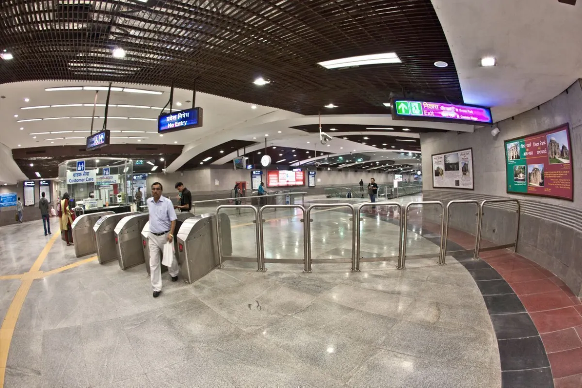
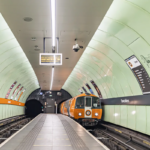
How to Ride the Metro Step-by-Step
A typical metro journey involves:
1. Enter Station
Use gates or staffed counters for entry.
2. Buy or Tap Ticket
Choose your fare from vending machines or card readers.
3. Pass Through Gates
Tickets or cards are needed for entry and sometimes exit.
4. Find the Correct Line
Follow color-coded signage and overhead boards.
5. Determine Travel Direction
Directions are labeled by terminal station (e.g., “Direction: Shinjuku”).
6. Board Train
Wait behind safety lines; let passengers exit first.
7. Transfer if Needed
Follow “Transfer” signs to switch lines.
8. Exit Station
Scan card/ticket at exit gates (distance-based systems).
This consistent format applies across most large metro networks worldwide.
Peak vs Off-Peak Travel
Metro experience varies significantly depending on time of day.
Peak Hours (Rush Hours):
- Weekdays: 7–10 AM, 4–8 PM
- Very crowded
- Higher frequency
- Limited seating
Off-Peak Hours:
- Midday, late evenings, weekends
- Less crowded
- Ideal for tourists
- Easier for luggage transport
Certain systems offer off-peak fare discounts or night trains on weekends.
Safety and Etiquette on Metro Lines
Metros are generally safe, but dense crowds require awareness.
Basic metro etiquette:
- Stand on the right on escalators (varies by city)
- Let passengers exit before boarding
- Keep backpacks low or in front during rush hour
- Give priority seats to elderly, disabled, pregnant passengers
- Avoid blocking doors
- Use headphones for audio
Safety precautions:
- Watch gaps between platform and train
- Secure phones and wallets against pickpockets
- Follow emergency announcements
- Know exit routes at interchange stations
Asian metros are known for high discipline and cleanliness, while European metros sometimes require extra pickpocket caution.
Best Metro Systems Around the World in 2026
Certain metro systems stand out for efficiency, cleanliness, automation, or design.
Tokyo Metro + Toei Subway (Japan)
- Massive network
- Fast, clean, punctual
- Perfect signage
- Excellent airport connectivity
Seoul Metropolitan Subway (South Korea)
- Free Wi-Fi on trains
- Heated seats in winter
- Convenience stores in stations
Singapore MRT (Singapore)
- Driverless trains
- Integrated transit system
- Clear English signage
- Accessibility friendly
Paris Métro + RER (France)
- Huge coverage
- Dense stations
- Connects airports and suburbs
London Underground (UK)
- Oldest metro in the world
- Zone-based fare system
- Modernized contactless payments
Dubai Metro (UAE)
- Driverless red and green lines
- Extremely clean and safe
- Air-conditioned walkways
New York Subway (USA)
- 24/7 system
- Massive coverage across boroughs
- OMNY contactless payments
Hong Kong MTR (China SAR)
- Punctual, cheap, commuter-friendly
- Airport Express integration
Shanghai Metro (China)
- One of the world’s largest networks
- Rapid expansion
- Multi-language signage
These systems offer diverse experiences for commuters and visitors.
Cities Expanding Metro Lines in 2026
Metro construction is booming globally due to population growth and congestion.
Major ongoing expansions include:
- Delhi Metro (India)
- Mumbai Metro (India)
- Cairo Metro (Egypt)
- Riyadh Metro (Saudi Arabia)
- Istanbul Metro (Türkiye)
- Tehran Metro (Iran)
- Los Angeles Metro Rail (USA)
- Jakarta MRT (Indonesia)
- Bangkok MRT (Thailand)
- Manila Metro Rail (Philippines)
New stations, lines, and extensions improve accessibility for both locals and travelers.
Metro Line Access for Airports
Many airports are connected to metro systems, reducing taxi dependency.
Examples include:
- Heathrow ↔ London Underground (Piccadilly Line)
- Narita ↔ Tokyo Metro via Skyliner & JR
- Changi Airport ↔ Singapore MRT (DTL/EWL)
- Dubai Airport ↔ Dubai Metro (Red Line)
- CDG Airport ↔ Paris RER B
- JFK ↔ AirTrain + Subway
- Hong Kong Airport ↔ Airport Express + MTR
- Istanbul Airport ↔ Metro M11
Airports connected by metros allow travelers to save time and money.
Accessibility and Inclusivity in Metro Systems
Modern metro systems prioritize accessibility through:
- Elevators and ramps
- Braille signage
- Tactile floor guides
- Priority seating
- Wheelchair spaces
- Visual and audio announcements
Cities like Singapore, Seoul, and Tokyo are global leaders in accessibility design.
Frequently Asked Questions
Are metro systems safe for solo travelers?
Yes, metros are generally safe, especially during daytime. Late nights in some cities require caution.
Do metros run 24/7?
Only a few cities (e.g., New York) have 24/7 service. Many close between midnight and 5 AM.
Can I use credit cards to pay for metro rides?
Yes, many metros now accept contactless payments directly at gates.
Is metro travel cheaper than taxis?
Almost always—metros are designed to be cost-efficient.
Final Thoughts
Metro systems make urban life possible for millions and provide travelers with efficient, reliable, and affordable mobility. With digital ticketing, real-time mapping, airport connections, and expanding lines, metros in 2026 are more convenient than at any point in history. For tourists, metros offer the fastest way to move across unfamiliar cities without getting stuck in traffic or spending heavily on taxis. For daily commuters, metros are essential for accessing jobs, schools, hospitals, and commercial centers.
Understanding how to read metro lines, use tickets, follow safety etiquette, and navigate interchanges transforms what could be a confusing network into a powerful travel tool. As more cities build new lines and modernize old ones, metro travel will only continue to expand—bringing smoother, greener, and smarter public transportation to the world’s busiest urban centers.
